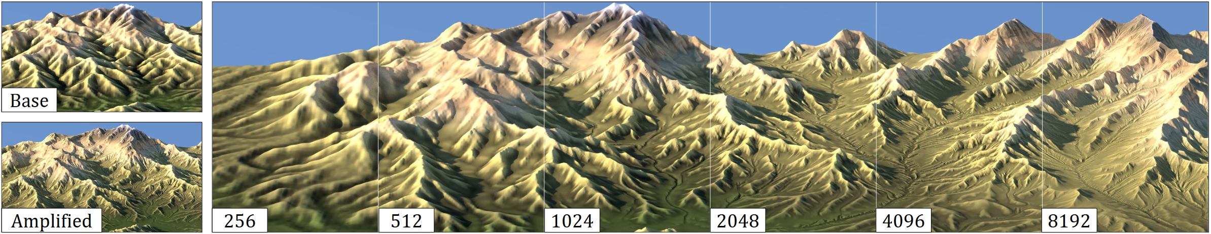
Modeling high-resolution terrains is a perennial challenge in the creation of virtual worlds. In this paper, we focus on the amplification of a low- resolution input terrain into a high-resolution, hydrologically consistent terrain featuring complex patterns by a multi-scale approach. Our framework combines the best of both worlds, relying on physics-inspired erosion models producing consistent erosion landmarks and introducing control at different scales, thus bridging the gap between physics-based erosion simulations and multi-scale procedural modeling. The method uses a fast and accurate approximation of different simulations, including thermal, stream power erosion and deposition performed at different scales to obtain a range of effects. Our approach provides landscape designers with tools for amplifying mountain ranges and valleys with consistent details.
author = {Schott, Hugo and Galin, Eric and Gu\'{e}rin, Eric and Peytavie, Adrien and Paris, Axel},
title = {Terrain Amplification using Multi-Scale Erosion},
year = {2024},
issue_date = {July 2024},
publisher = {Association for Computing Machinery},
address = {New York, NY, USA},
volume = {43},
number = {4},
issn = {0730-0301},
url = {https://doi.org/10.1145/3658200},
doi = {10.1145/3658200},
journal = {ACM Trans. Graph.},
month = jul,
articleno = {145},
numpages = {12},
keywords = {landscapes, erosion simulation}
}